

Monarch Surveyors & Engineering Consultants Ltd. (MSECL) is engaged in the business to provide comprehensive consultancy services under Concept to Commissioning of infrastructure projects which includes Survey, design and technical supervision for roads, railways, metros, town planning, geospatial, mapping, land acquisition, water, transmission Line, pipelines and other civil engineering sectors.
It is providing comprehensive consultancy services throughout the entire lifecycle of infrastructure projects, from concept to commissioning. MSECL’s expertise spans a wide array of sectors, including:
Surveying: It conducts detailed surveys to gather critical data, ensuring that all project planning is based on accurate and reliable information.
Design Services: Its team designs innovative and efficient infrastructure solutions tailored to the specific needs of each project, ensuring compliance with all regulatory requirements.
Technical Supervision: It provides oversight and management during the construction phase, ensuring that all work aligns with the established design and quality standards.
Roads and Highways: It designs and supervises the construction of roadways that enhance connectivity and promote safe travel.
Railways and Metros: Its expertise includes designing and managing rail projects that improve urban and regional transportation.
Geospatial and Mapping: The company utilizes advanced geospatial technologies to provide accurate mapping and spatial analysis, supporting informed decision-making.
Land Acquisition: It assists clients in navigating the complexities of land acquisition processes, ensuring compliance and efficiency.
Water Management: The company designs and implements water infrastructure projects, focusing on sustainability and resource management.
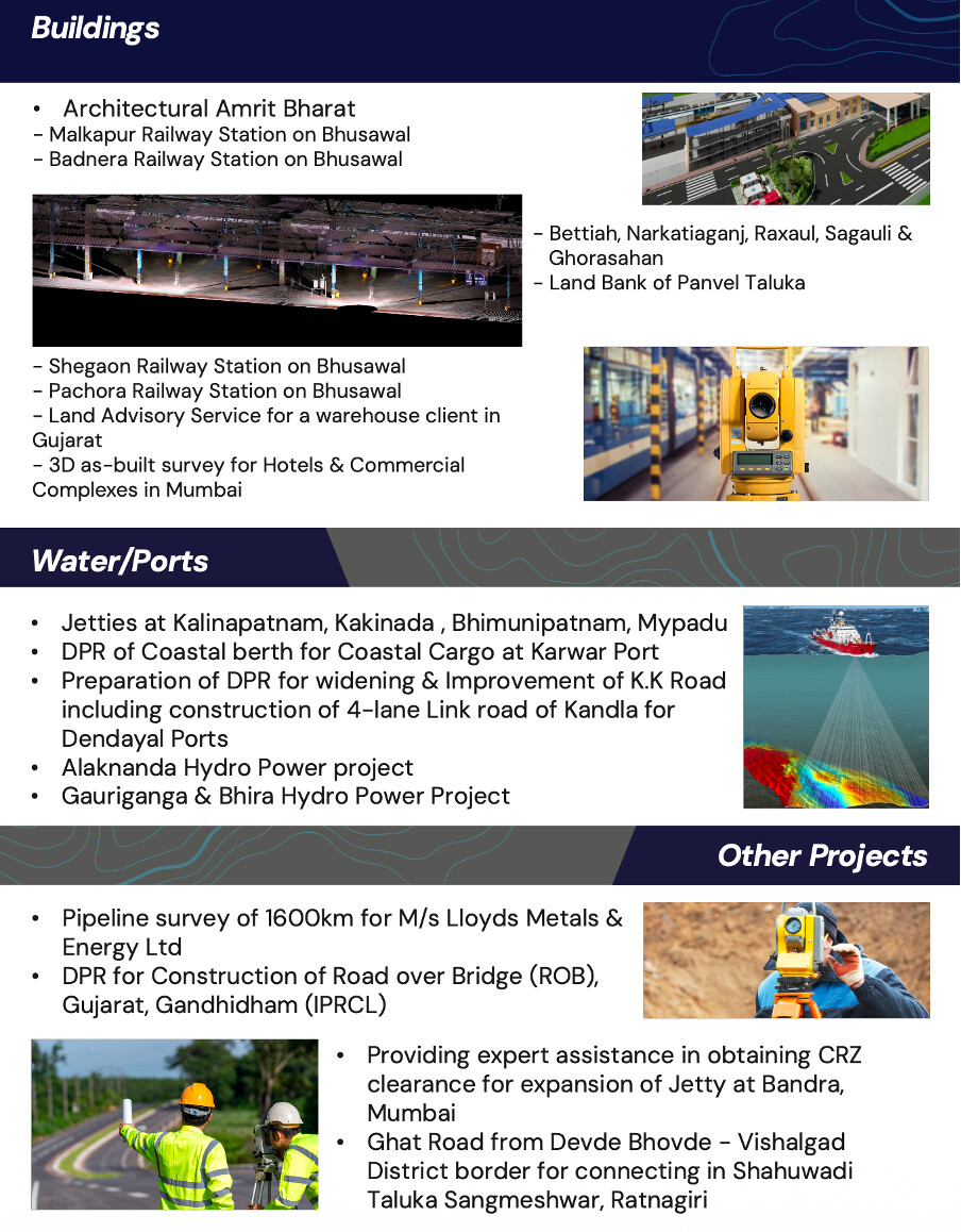
Transmission Lines and Pipelines: Its services extend to the planning and execution of essential utilities, ensuring they meet the demands of modern infrastructure.
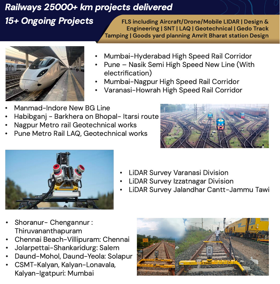
It is providing end to end services with a diverse workforce specializing in Detailed Engineering, Project Management, Construction Supervision, Facilities Design, Land Surveying, Land Acquisition Services, Geospatial mapping, Geo-technical Investigation and Special Inspections. It has several administration and site offices across India.
As of March 31, 2025, it had 507 employees on its payroll.
IPO:
The company came out with its maiden book building route IPO of 3750000 equity shares of Rs. 10 each to mobilize Rs. 93.75 cr. at the upper cap. The company has announced a price band of Rs. 237 – Rs. 250 per share. The stock was listed on BSE SME on 29 July 2025. The lot size is 600 shares.
From the net proceeds of the issue, the company will utilize Rs. 30cr for working capital, Rs. 32cr for capex on purchase of machinery, and 22.8cr for general corporate purposes.
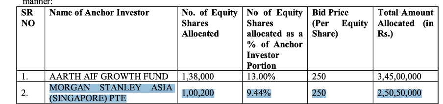
Among the list of anchor investors, notable is Morgan Stanley

Some Videos to understand more about the Company:


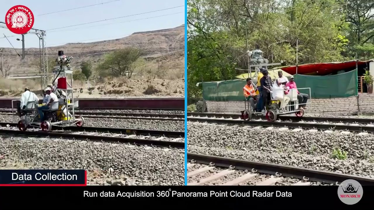

===========================================================================
Akshay Inamkay writes on Twitter:
It’s in my circle of competence as an architect.
-
Few weeks ago it received orders worth 130cr in one day. Current topline is around the same.
-
MSCEL specializes in delivering consultancy services across the entire lifecycle of the infrastructure projects from Concept to Commissioning. The company’s expertise spans multiple domains like Survey, design, and technical supervision for roads, railways, metros, town planning, geospatial, mapping, land acquisition, water, transmission Line, pipelines, and other civil engineering sectors.
-
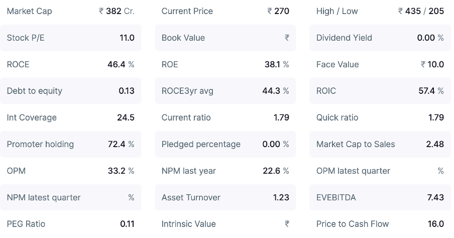
Good consultancy company trading at 10 P.E. with good cash flows.
Pune municipal corporation is cash cow for them.
-
My firm(Architectural Consultancy) pays nearly 2-3 lakhs a year or more than that for their survey related works.
-
There are many such firms which pays them hefty amount every year for survey works in Pune municipal corporation as surveyor for plot survey before starting the construction on site .
-
it’s the “only” empanelled consultant of Pune Municipal Corporation.
~ Good business model in service sector,
~ Light assets model
~ High margin business.
The capex boom India is witnessing is huge .
-
Forayed into railway , highway , airport consultancy and with digital platform for ease of doing business many municipal council will ask for survey works monarch provides.
-
Consultancy services are best as it is less capital intensive and generates higher return ratios.
Just before Covid their office was hardly 500sq.ft now doing topline of 130cr+.
What a rise .
Services provided by them:
a) Surveying:
Conducts detailed surveys to collect essential data for infrastructure planning and ensures project decisions are based on accurate and verifiable inputs.
b) Design Services:
Prepares infrastructure designs tailored to project-specific requirements and ensures alignment with applicable regulatory standards and technical specifications.
c) Technical Supervision:
Provides on-site oversight during construction and monitors execution to ensure conformity with approved designs and predefined standards.
Why monarch surveyors
-
As India Capex story is just at initial stage I see many digitalization of land records that will be available at click for common people that need mapping every inch of land.
With monarch capabilities they will surely get a big pie. -
Every Local bodies have started mapping properties for Tax purposes this will also be another sector monarch will be looking for.
Key Risk Factors:
 High Client Concentration:
MSECL’s earnings are largely dependent on government contracts, with the top 10 clients contributing around 83–86% of total revenue over recent years. Any slowdown in public infrastructure investments could significantly affect the company’s growth and order inflow.
 Geographical Dependence:
Nearly 84% of FY25 revenue originates from projects within Maharashtra, reflecting a strong regional concentration. This limited geographical diversification exposes MSECL to state-specific economic or policy risks.
 Working Capital Pressure:
Trade receivables rose sharply from ₹9.86 crore in FY24 to ₹39.63 crore in FY25, while debtor days almost doubled from 50.4 to 93.8 days. Such a trend indicates possible delays in payments and tighter liquidity management.
 Increasing Contingent Liabilities:
Reported contingent liabilities climbed to ₹16.16 crore in FY25 from ₹13.39 crore in FY24. If these obligations crystallize, they could weigh on the company’s financial stability.
 Cash Flow Strain:
The company recorded negative cash flow from both investing (₹28.70 crore) and financing (₹0.37 crore) activities in FY25, reflecting possible liquidity stress and reduced financial flexibility.
Some Key Questions:
-
How do you see them expanding PAN India, do they have competitive edge (in any domain)?
-
Is equipment such an important thing in this industry, as the only differentiation I can see is they have a lot of equipment with them unlike competitors ?
-
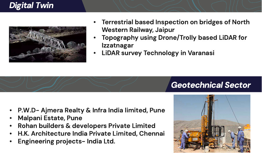
Most revenues are from DPR of Roads and Railways, how do you see opportunities in Geospatial , Digital Twin, Energy & Water Sector.
-
In March-24 number of employees was around 400, In March-25 it went to 500 and as of August’25 it is at 660. So is revenue proportional to employee base ?
-
On margins front, is it sustainable ?
-
On their LinkedIn Page, they seem to be very much interested in Middle East Market, are Indian consultancy companies capable to deliver such high value projects ?
Akshay Answers:
- Expansion PAN India already there, next FY their revenue from Maharashtra will decline to less than 60%.
Recent announcements underscore this expansion:
On October 11, 2025, the Company secured Letters of Acceptance (LoAs) for land acquisition consultancy on the Somnath-Dwarka Expressway (Gujarat), totalling ~₹100.91 crore across packages (e.g., ₹41.43 crore for Rajkot-Dwarka, ₹37.67 crore for Rajkot-Porbandar, ₹21.81 crore for Jetpur-Somnath). Work commences immediately.
Another LoA for ₹6.19 crore for DPR, surveys, and design on the Jammu Tawi (JAT) to Shri Mata Vaishno Devi Katra (SVDK) new BG railway line (Jammu Division), also dated October 11, 2025.
This indicates scaling in Gujarat and Jammu/Kashmir, building on existing offices in Pune, Nagpur, Delhi, and others
Competitive Edges:
The Company has strong advantages in surveying and engineering consultancy for roads and railways:
End-to-end services: From surveys and DPR to supervision and land acquisition, offering a “one-stop-shop” that minimizes client multi-vendor needs.
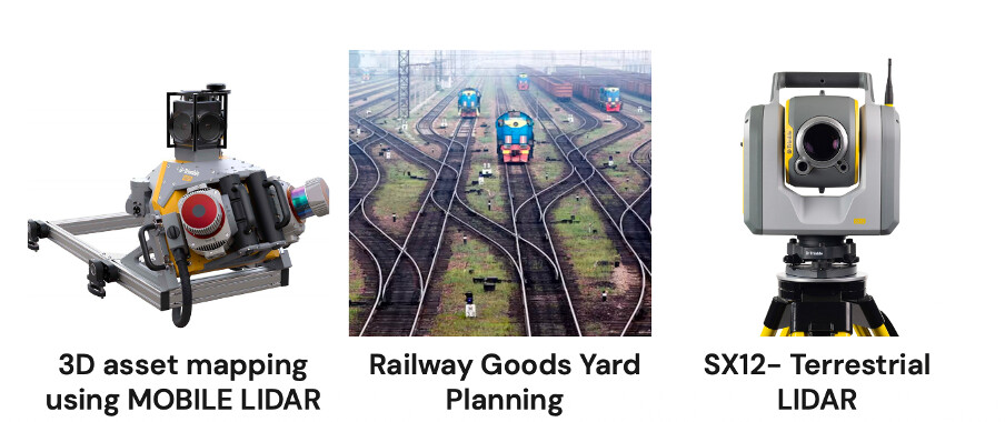
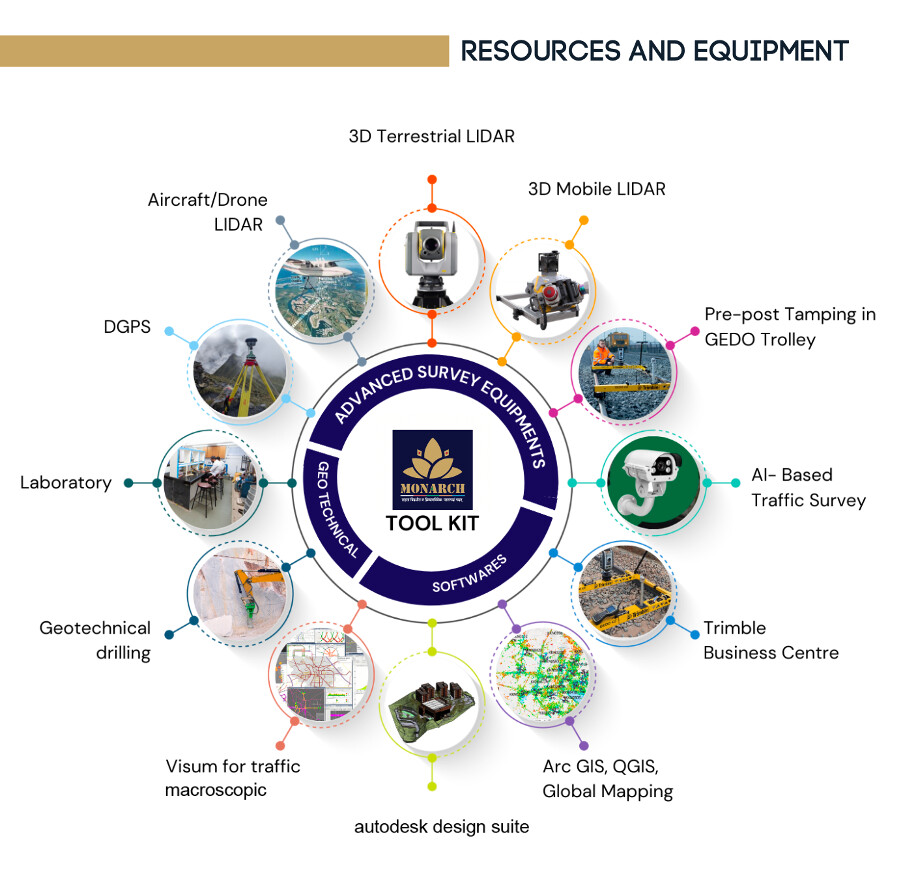
Technology adoption: Use of LiDAR, DGPS, drones, and GIS for precise, efficient work, enabling high-accuracy DPRs and designs.
Quality recognition: Ranked as one of the “Top 10 Engineering Consultants in India” by Industry Outlook (2022), with 25+ years of promoter expertise in civil engineering.
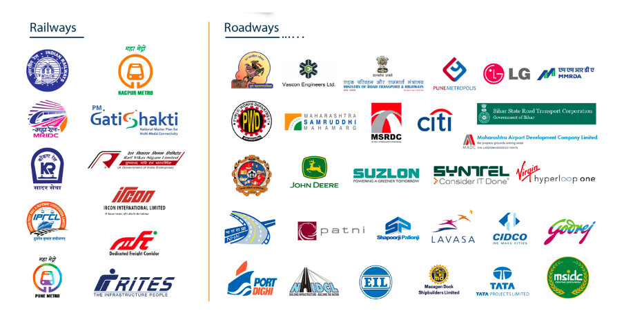
In roads/railways, edges include NHAI/Railways empanelment for DPR and safety, plus cost efficiency from in-house execution, driving 94.61% revenue growth in FY24.
- Importance of Equipment in the Industry and Differentiation
Yes, equipment is crucial in the infrastructure consultancy industry, especially for surveying, DPR preparation, and project design in roads and railways. Precision tools ensure compliance with standards, reduce errors, speed up execution, and cut costs in time-sensitive government projects. Manual methods are outdated; modern tech like LiDAR handles large-scale mapping efficiently, which is vital for national infrastructure (e.g., expressways, rail alignments).
The Company’s heavy investment in equipment (₹13.35 crore in FY24, mainly LiDAR) is a key differentiator:
Unlike many competitors reliant on outsourcing (which the Company reduced dramatically), it uses in-house LiDAR for 3D topographic surveys, DGPS for positioning, drones for aerial data, and GIS/CAD for designs. This shifted subcontracting from 88.84% (FY23) to 20.47% (FY24), boosting EBITDA margins from 16.29% to 30.67%.
Differentiation: Enables faster, accurate delivery for complex projects (e.g., recent railway DPR in Jammu using surveys/geological studies).
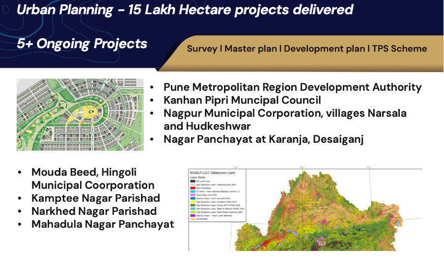
- Geospatial: Strong potential and current strength—already core to services (LiDAR/GIS for mapping, land use, town planning). Empanelled for PAN India geospatial surveys; investments in drones/LiDAR position it for growth in urban planning/infrastructure mapping. The RHP implies expansion here via tech upgrades, tying into roads/rail (e.g., alignment surveys), with opportunities in government digital initiatives.
Already they have done work of mapping Pune water streams major and minors .
They do surveys for Elevation certificate part of geospatial survey.
New stream as I said would be property tax survey, existing land use planning (ELU), Proposed Land use (PLU) , DP and RP planning where ever Urban body has huge amount sanctioned under finance commission.
With new census new Urban bodies will be notified and this new bodies will carry all this geospatial surveys using ARC GIS , LiDAR.
With focus of achieving SUSTAINABLE Development Goals more type of ecological surveys will be carried out.
So huge TAM ahead.
- Employee growth
Happened due to inhouse revenue and cancelling subcontracting their works.
With new equipment they need a team for work to carried out smoothly.
I have seen them working with mere 20-30 employees back in 2016-17 .
- Sustainability of Margins
Margins are sustainable in the near term, based on improving trends and structural shifts (FY23-FY25):
EBITDA Margin: 16.29% → 30.67% → 33.15% (stable/improving via in-house work).
PAT Margin: 11.98% → 21.51% → 22.60% (revenue growth outpacing costs).
Gross Margin: 40.34% → 51.90% → 56.48% (subcontracting down to 7.94% of turnover).
Continuous improvement in margins and ratios .
But this can change when they foray into big Govt projects B2G will delay payments.
- About middle East projects:
AECOM is listed firm in consultancy work on similar lines throughout the globe.
Also having good projects in India.
BIM is the future for management of construction related activities which can be easily acquired by Monarch.
(BIM stands for Building Information Modeling, a digital process that creates and manages comprehensive information about buildings and infrastructure throughout their lifecycle. BIM uses intelligent 3D models and shared data environments to enable collaboration among architects, engineers, contractors, and facility managers, streamlining design, construction, and maintenance tasks
1.BIM is much more than just 3D modeling—it includes geometric, spatial, and semantic data about all aspects of a building or infrastructure project.
2. It connects people, processes, and technology to deliver synchronized project management and improved outcomes.
3. BIM data can be used for simulation, scheduling, cost estimation, and lifecycle management of assets)